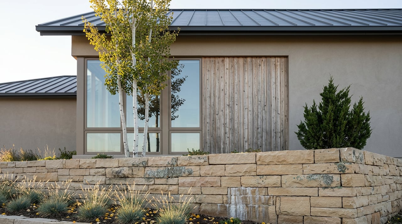
Utah County's Bench Lots Command a View Premium. The Fault Beneath Them Writes the Real Price.
September 24, 2026
September 24, 2026
In the summer that URS Corporation, the Utah Geological Survey, and researchers from the University of Utah set out to dig the deepest trench ever cut across the Wasatch Fault, they picked a spot about eight miles southeast of Provo, on the southern third of what geologists call the Provo segment. The goal was to expose more than 11,000 years of the ground's memory, doubling the paleoseismic record available for that stretch of the fault. The site they chose sits in Mapleton, on the same bench that today carries some of northern Utah County's largest estate lots.
That trench is gone now, backfilled and grassed over. But the reason researchers went there hasn't changed, and neither has the reason today's buyers want to build there. The bench exists because the fault moved. Every foot of elevation that separates a Mapleton or American Fork view lot from the valley floor below is the residue of the same vertical displacement that geologists spent a summer measuring. The view and the hazard are not two different features of the property. They are the same feature, read two different ways.
The Wasatch Fault is a normal fault, which in plain terms means the mountain side goes up relative to the valley side over repeated earthquake cycles, not gradually but in sudden jumps separated by centuries of quiet. Along the Provo segment, that repeated motion is what built the string of benches running from the mouth of American Fork Canyon down through Highland, Pleasant Grove, and Mapleton. The National Park Service describes American Fork Canyon itself as producing "tremendous soil and terrain diversity" as it drains toward the valley floor, a mix of Precambrian quartzite, Cambrian and Mississippian limestone, and younger rock that alluvial fans have been depositing across the foothill bench for millennia.
None of that geology is a defect. It's the reason a custom home sited on the bench looks down over the valley instead of across it. But it's also the reason a lot on that same bench is more likely to sit inside what the Utah Geological Survey calls a special-study area: ground close enough to a mapped fault trace that a site-specific investigation is recommended before anyone finalizes a building envelope.
Most Utah County bench cities have some fault-hazard mapping on file. Mapleton has more than most. In 1984, state geologist B.N. Kaliser published a faulting hazard zonation of the city that defined two distinct risk zones along its eastern margin, based on surface investigation and trenching that had already been underway. Later trench studies logged in that same area found net vertical displacement from a single late Holocene faulting event of between roughly four and a half feet and nearly ten feet, the kind of number that explains why setback recommendations for this fault exist in the first place.
That history is not a reason to avoid Mapleton's bench. It's the opposite. It means the ground under some of the city's most desirable lots has already been read more carefully than almost any comparable terrain in the state. Mapleton has also chosen to protect the character of that same foothill land through a transferable development rights program, with minimum lot sizes ranging from a third of an acre to two acres and no direct interstate access, by design, to preserve the large-lot rural feel that draws custom-home buyers there in the first place. The city's premium acreage and its fault record sit on the same map. A buyer evaluating one should expect to hear about the other.
Engineering literature on the Wasatch Fault generally recommends a minimum building setback of 40 feet on the uphill side of a mapped fault trace and 50 feet on the downhill side, since displacement tends to spread further into the downthrown block. Whether that setback gets enforced, and how, depends on the city or county, which is part of what makes this the kind of detail a listing sheet never mentions. A few miles east in Wasatch County, planning commission minutes from November 2025 show staff requiring a geotechnical report for any lot with a building envelope steeper than 25 percent grade, a threshold written directly into the subdivision review process. Wasatch County's zoning code goes further, listing geotechnical studies alongside road frontage and sewage disposal as baseline conditions a lot must satisfy before a building permit can even be issued.
Utah County's bench cities apply the same underlying logic, city by city, without always spelling it out in one clean sentence. And the requirement compounds with something that has nothing to do with any specific fault trace: the entire Wasatch Front, Utah County included, is classified Seismic Design Category D under the state's adopted building code, with some sites falling into the more demanding Category E. That classification alone triggers stricter engineering for a home's lateral force-resisting system, meaning even a bench lot that clears a fault-hazard review still carries foundation and framing requirements a valley-floor lot elsewhere in the state would not.
A geotechnical report ordered before you write an offer costs the same as one ordered after. The difference is what you can still change when the results come back.
Custom home construction across Utah County in 2026 runs roughly $225 to $500 or more per square foot, and site conditions are one of the biggest reasons that range is so wide. A sloped bench lot can add something in the neighborhood of $50,000 in dirt work and specialized foundation engineering on its own, separate from the soils report itself, which typically runs $2,000 to $6,000 and takes two to four weeks before a design can move forward with any confidence. If that report comes back showing soil variability, which is routine rather than exceptional on bench terrain, some sites require deeper footings or pier systems, adding time to a phase most buyers assume is already finished.
Impact fees layer on top of that. In cities like Alpine, those fees alone can exceed $20,000 to $25,000 per home, a separate cost from anything geotechnical but one that concentrates in the same foothill communities where infrastructure investment runs heavier. None of these numbers show up in a per-square-foot estimate pulled from a listing or a builder's rate sheet. They show up in the due-diligence period, after the lot is under contract, when the timeline is already running.
The practical move is to treat the geotechnical and fault-hazard question as part of lot selection, not part of design. Ask whether the parcel falls inside a mapped special-study area before the purchase contract's due-diligence clock starts, not after. Ask the specific city, since American Fork, Highland, Alpine, Pleasant Grove, and Mapleton each handle the trigger a little differently, some by slope percentage, some by proximity to a documented trace. And treat a location's trenching history, wherever it exists, as a point in the property's favor rather than a warning label. Ground that state geologists have already studied closely is ground a builder's engineer will have an easier time evaluating than ground nobody has looked at yet.
The view from a Utah County bench lot is real, and so is the premium buyers pay for it. What the megatrench under Mapleton makes plain is that the premium was never just about elevation. It was always about the same fault that built the view, and the paperwork that comes with building on top of it.
If you're evaluating a bench or foothill lot anywhere from American Fork to Mapleton and want a clear-eyed read on what a specific parcel's geotechnical history actually means for your build, Echelon Luxury Homes works these communities closely enough to help you ask the right questions before you write the offer, not after. Request a private consultation to talk through a specific lot.

Whether you’re searching for a secluded, Sundance mountain retreat or a custom masterpiece in Wasatch, Salt Lake, or Utah Counties, she offers a concierge-level experience designed to help you find a home that embodies your vision of the extraordinary.